Guadalupe Enciso
Leonardo Tamayo
CISDER Consultores, México
This document describes the experience of using a GIS as a planning tool for High Schools Public System at Mexican State of Hidalgo.
Introduction. Brief Review of Hidalgo.
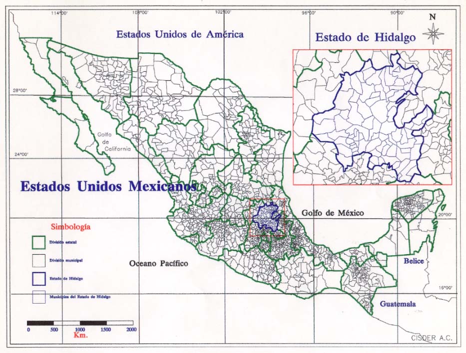
Hidalgo is a Mexican State (or Province). Its territory covers 2,000 square kilometres. Hidalgo is located at eastern edge of Mexico's central plateau, 60 Miles far from Mexico City. Today, 2.1 million inhabitants live there.
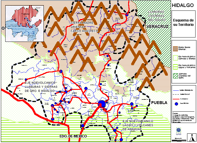
HIDALGO. REGIONES FISIOGRÁFICAS
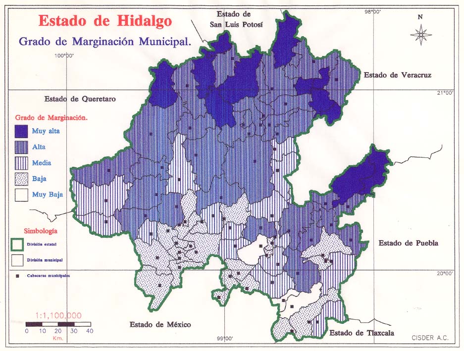
Hidalgo is an underdeveloped territory of a developing country.
It is today the 4th most marginated (poorest) Mexican Province, and Its
SIERRA (Northern) region is the poorest area of Hidalgo.
HIDALGO. MARGINALIDAD MUNICIPAL
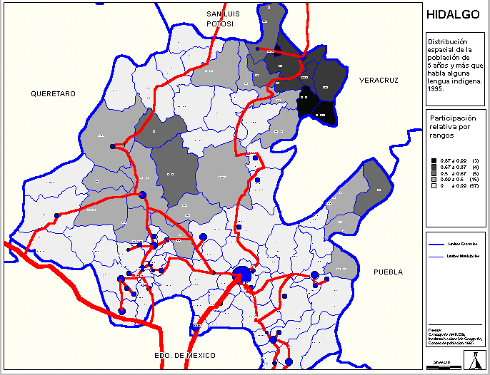
Population of SIERRA is basically integrated by naturals (Indian origin). Two ethnical lines are prevalent (náhuas and ñañhús). In Hidalgo coexist today two cultures. An Indian culture, self-nurtured, and a "mestizo" culture, oriented to Western values. Indian language speaking population share (15.2% Hidalgo versus 6.0% National)
IF Rural sites are those with 5,000 inhabits. Or less In 99% sites lived 60% of population.
MEXICO. POBLACIÓN URBANA Y RURAL 1970-1995
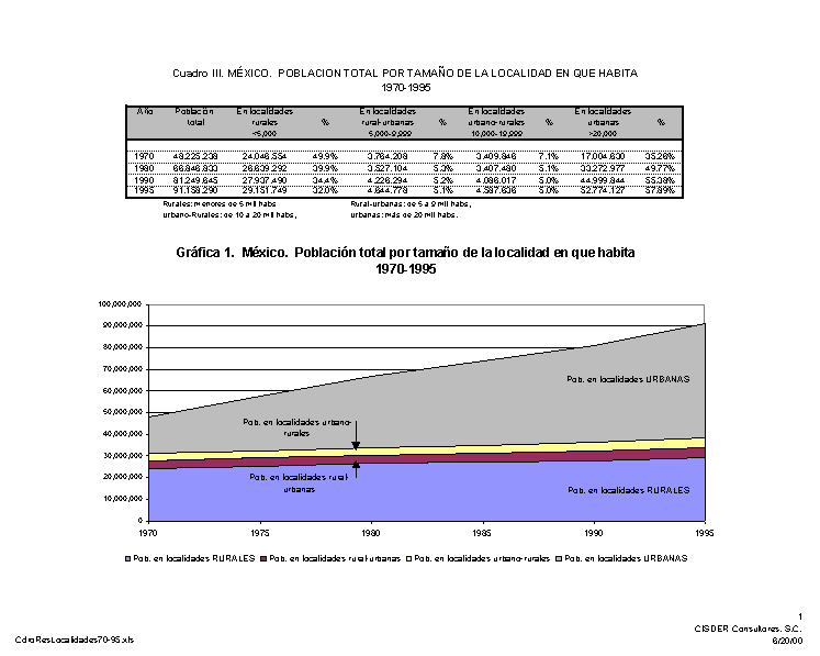
IF Urban sites are those with 20,000 inhabit. Or more In 44 (1%) sites lived 40% of population.
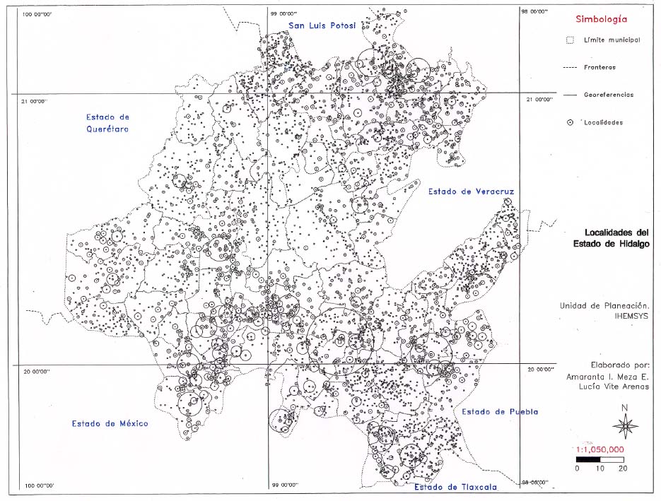
HIDALGO. LOCALIDADES I 1995
Hidalgo lives today a late process of urbanisation. It still shows a relatively higher level of rural population (60% Hidalgo versus 32% National) and a significant rural to urban migration.
HIDALGO. LOCALIDADES II 1995
Hidalgo still shows a few (44) urban places and a relatively lower rate of urban population. (40% Hidalgo versus 58% National)
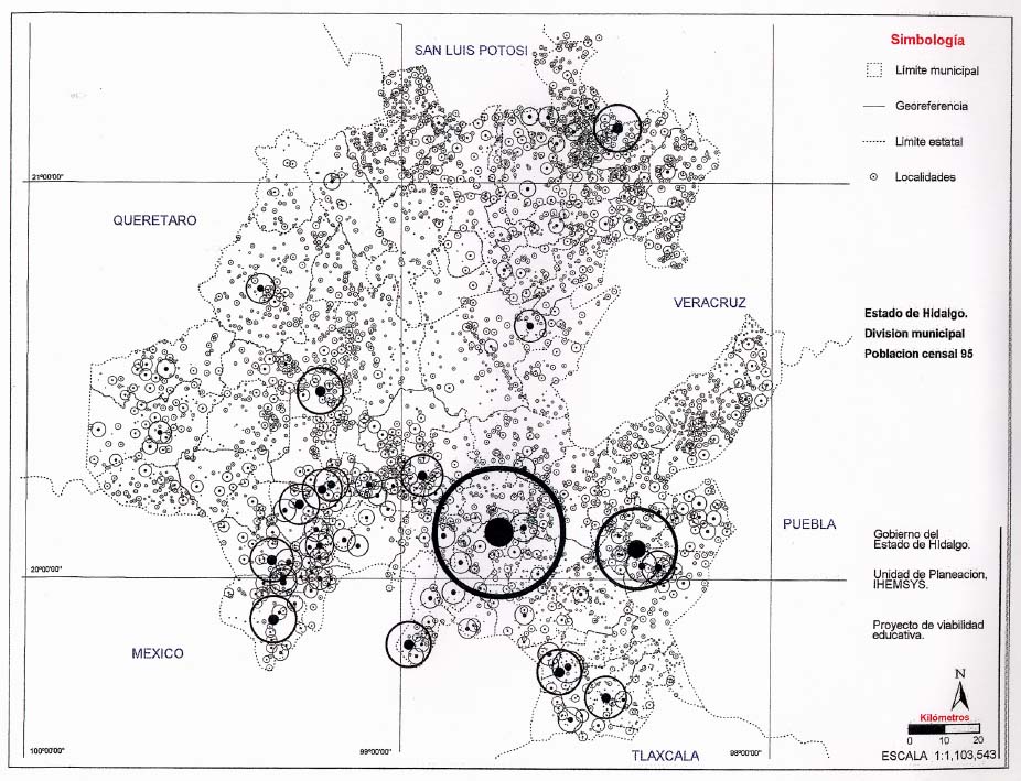
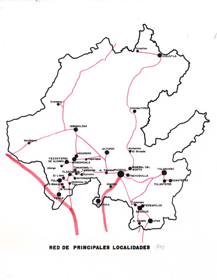
HIDALGO. RED DE LOCALIDADES URBANAS
Government of Mexican State of Hidalgo faces a clear challenge today: this is to provide basic services, especially educational services, to a disperse (rural) population.
FIRST PART
USING GIS FOR SCHOOL PLANNING
Education is a scarce good in Hidalgo. The 1995 rate of illiteracy was 13.4%. This is not the place for discussing about uneven opportunities for local population. We only point here out the use of GIS for documenting local educational deficit and rationalising growth of High School system.
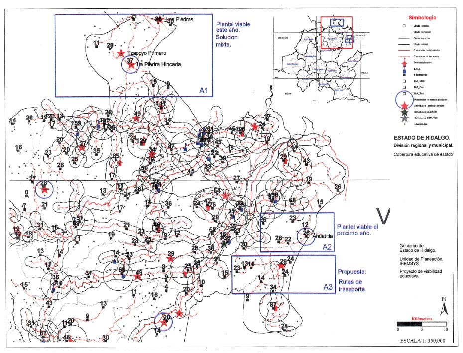
HIDALGO. PLANTELES DE EMS
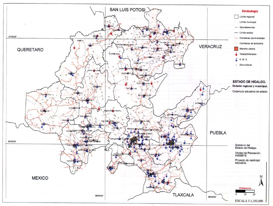
First, a GIS provided to us a territorial view of the global High School State System. 1998 The firs question to answer was:
Soon GIS was answering a vital question
Are High Schools covering the whole territory?
With the help of a GIS is possible and digitalized carthography is possible a simple spatial analysis.
On the global map of sites and population we overlap the map of High Schools and schools of previous level (or EMB)
Assumption:
Each school serves its own site and nearest places (40 minutes walk) also serves sites communicated by road not far of 5 or 10 kilometres, depending the kind of the road. We call here Influence Area to the sum of areas of service.
Information derived from spatial analysis is the great importance for planners. It is useful to evaluate choices and define strategies with lower cost/benefit relation.
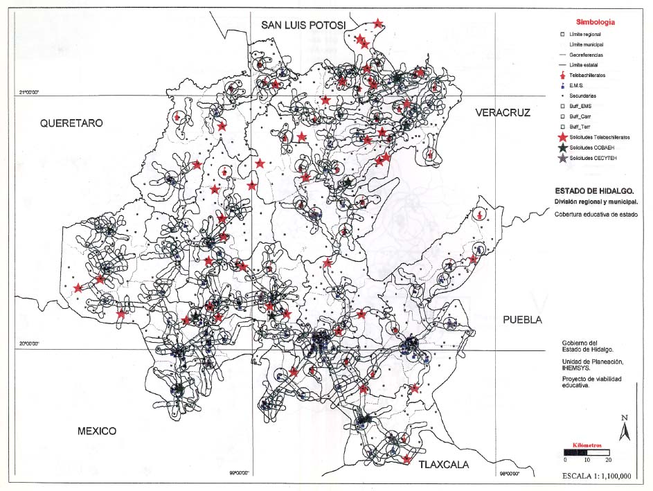
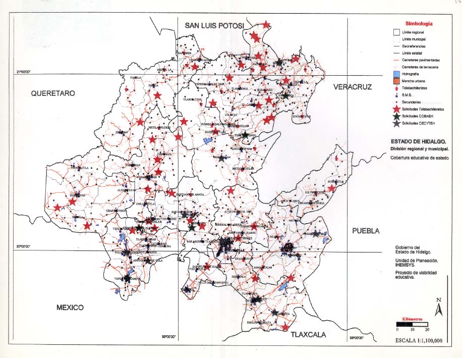
THE TELEBACHILLERATO: A school for rural´s Five years ago, local educators designed an especial kind of schools oriented to rural people. The schools were built around a TV set in each room
TELEBACHILLERATOS (Tbs.) soon were a State and educational success. Demand for Tbs. rise. It was needed then a planning tool for rationalising school growth. Use of a GIS helped local planning; also served for facing political pressures.
The Demand for new TELEBACHILLERATOS was commanded by
Soon a frequently question to answer was
What is the Viability of a planned School, especially Tbs?
Planners used then a GIS to recognise the regional context of proposed schools, which is to say
Four examples of use of GIS are presented
Example 1.
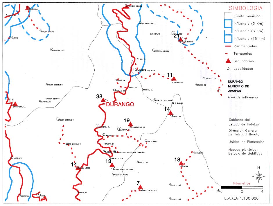
A demanded School at Durango
Durango is an off the road Sierra town. Isolated with not strong connections with urban system. Our GIS helped to demonstrate the low viability of proposed school.
School application rejected
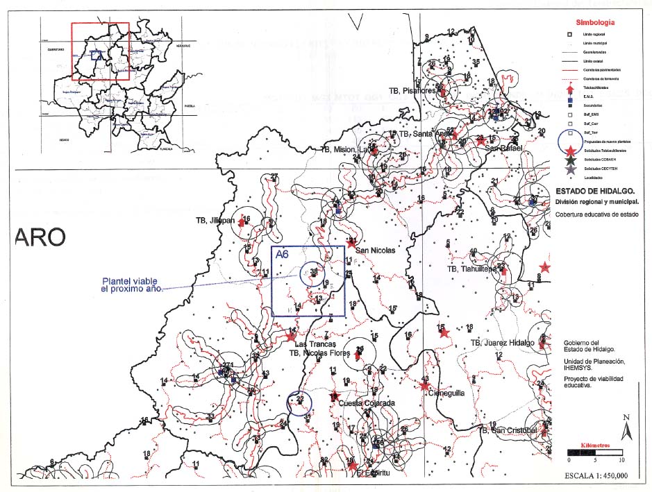
Example 2.
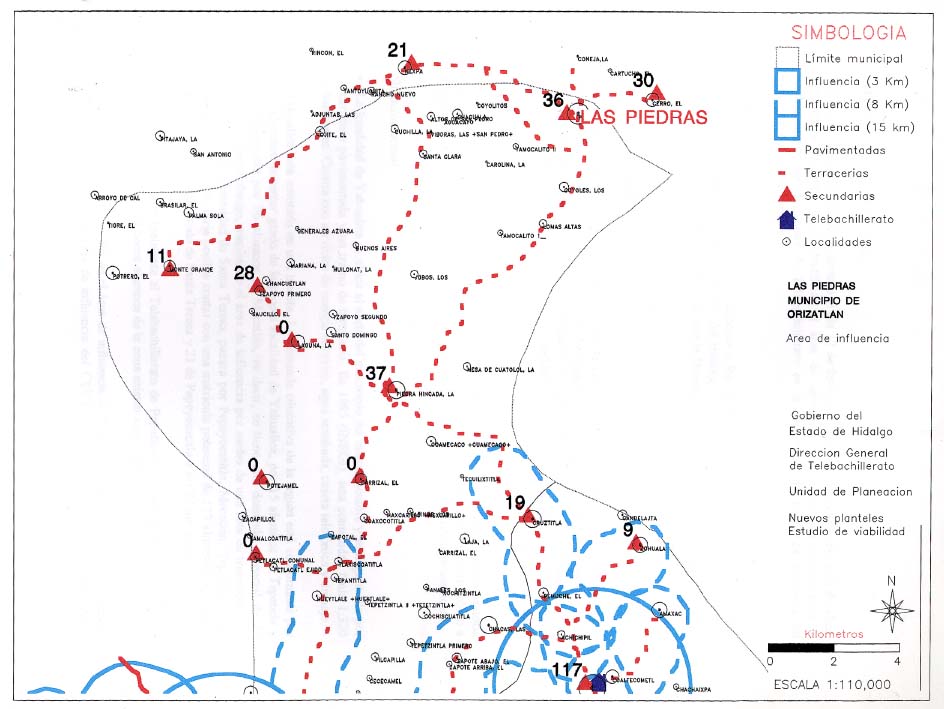
A TB demanded at Las Piedras-Piedra Hincada
Las Piedras and Piedra Hincada are two border towns, located at extreme north of Hidalgo, at Huasteca region. Original settlers were peculiar. Many of them choose that place to live because their problems with Hidalgo justice. Regional matricula was numerosa. Fieldwork, parallel to work with GIS, found important local infrastructure, useful for proposed school.
School at Las Piedras was approved. School transportation from Piedra Hincada was recommended to increase efficiency.
Example 3.
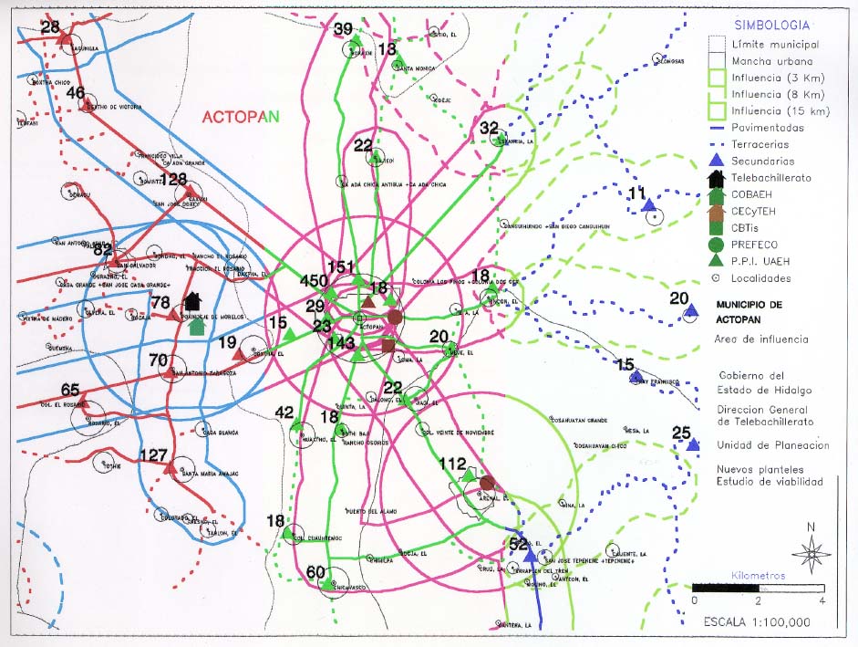
Approach to Actopan village & region
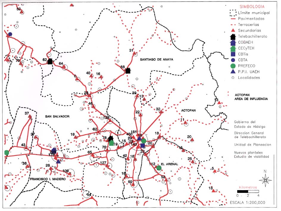
Governor Office asked TELEBACHILLERATO to study particular situation of ACTOPAN, local and regional level.
Actopan: 24,000 inhabit. (Core) 1995 A GIS was used for approaching the situation and deliver a proper answer.
Example 4.
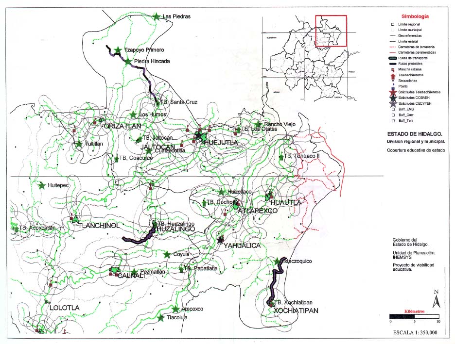
Use of a GIS for the design of Transportation Routes
Three years old, TELEBACHILLERATO revisited itself and reviewed its efficiency in terms of installed capacity
HIDALGO. SIERRA
HIDALGO. DURANGO
HIDALGO. HUASTECA
HIDALGO. LAS PIEDRAS
HIDALGO. ACTOPAN AREA
HIDALGO. ACTOPAN ZOOM
HIDALGO. TRANSPORTATION ROUTES. SIERRA
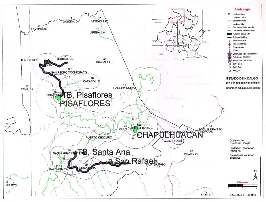
HIDALGO. TRANSPORTATION ROUTES. HUASTECA
SECOND PART (under construction)
A PROBLEM & A CHALLENGE
The Problem
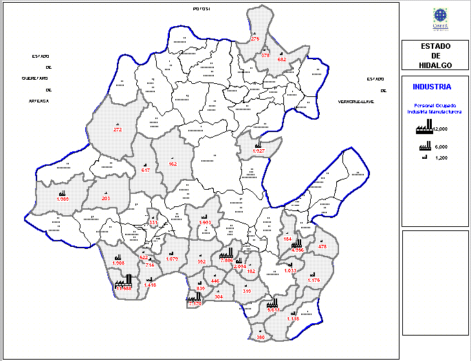
Economic Activity of a certain region may be not taken in account when designing Plans and Curricula of Colleges and High Schools. In these cases a divorce between School and Industry is set.
A goal of Public Policy may be to establish some basic or primary relationships between regional productive apparatus (specially the regional industry) and Colleges and High Schools Curricula
Hidalgo faces this challenge. It seems our GIS may help analysing the problem.
HIDALGO REVISITED
HIDALGO. POBLACIÓN OCUPADA EN EL SECTOR INDUSTRIAL
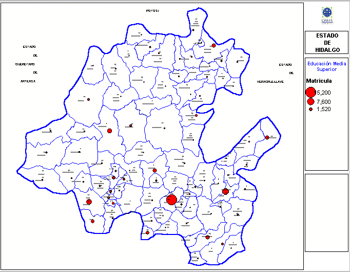
HIDALGO. MATRICULA DE EMS
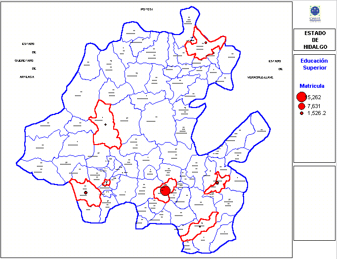
HIDALGO. MATRICULA DE ES
junio de 2000