DTED Classification of Tethys
All maps on this page use 1/3° cells of DTED level 0, which has some missing data cells shown in white.
There are 10 maps in 5 categories:
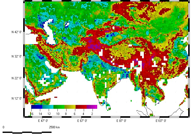
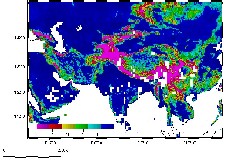
The five steepness measures all have different scaling, but all of the major terrain features show up clearly on all five maps. Major features of the region visible on all the maps include the Zagros Mountains in Iran, the ranges in Pakistan and Afghanistan, the Himalayas, farther north the Tien Shan and Tarim Basin, and the foreland basins with the Indus, Ganges, and Brahmaputra Rivers.
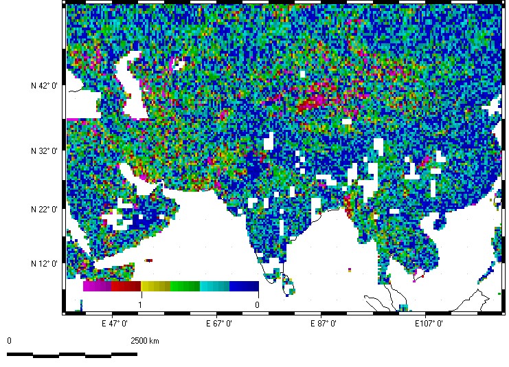
Flatness (ln(S1/S2))
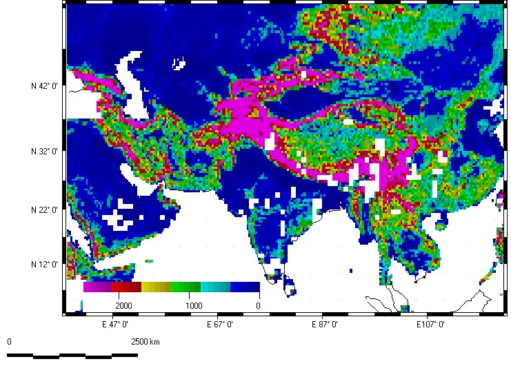
Relief (elevation range in sample area) in meters
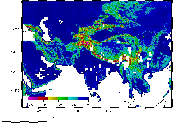
Standard deviation of elevation in meters
Average slope in percent
Standard deviation of slope in percent
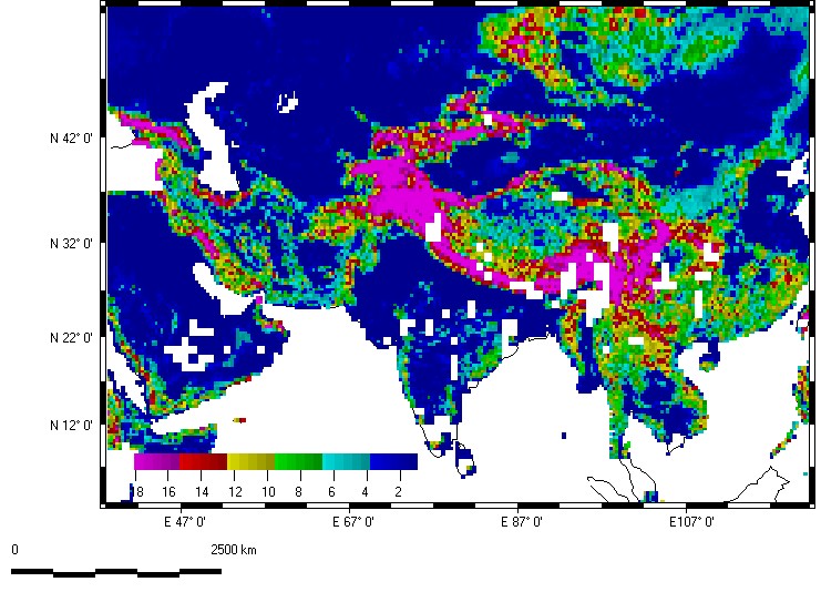
Note the highest organization in the Zagros Mountains of Iran, the Altun Shan on the north margin of the Tibet Plateau, and between India and Myanmar (former Burma). Many of these reflect folded mountains from the collisions of Arabia and India with Eurasia. The Himalayas show relatively low organization, as the rapid erosion produces nearly isotropic topography.
Organization (ln(S2/S3))
The Tibetan Plateau dominates this map.
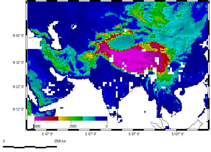
Average elevation
Two parameter classification
This classification uses
steepness, an inverted ln(S1/S2), to control the red color,
organization, ln(S2/S3), to control the green color.
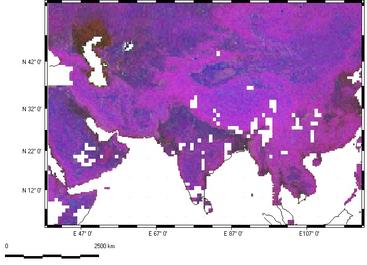
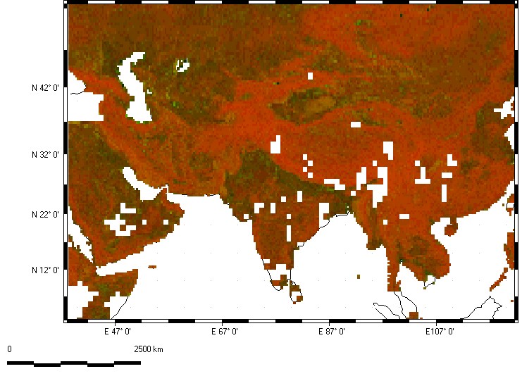
Three parameter classification.
This classification uses
steepness, an inverted ln(S1/S2), to control the red color
organization, ln(S2/S3), to control the green color
natural logarithm of elevation to control the blue color
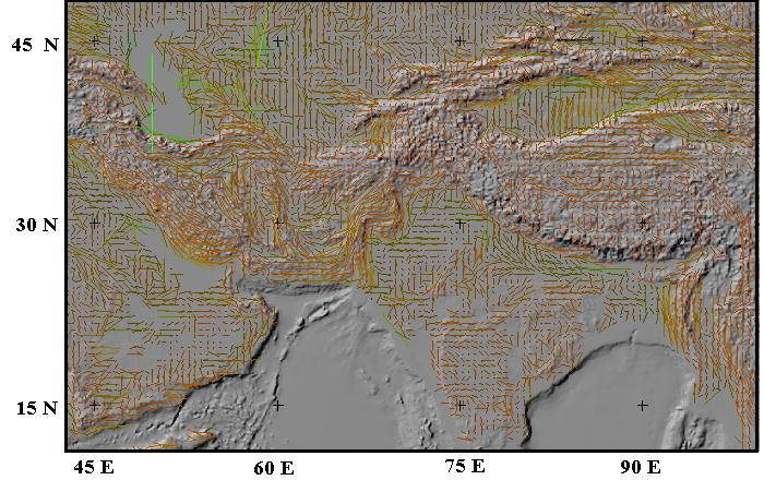
Grain overlay
This maps shows the fabric computed from DTED level 0 draped on a reflectance map from ETOPO5. The base map includes both topography and bathymetery, whereas the fabric data only occurs over land. The lines are oriented with dominant computed fabric, with the length proportional to the strength. The color reflects a flatness vs. organization plot. Note the bright green fabrics, such as those in the Caspian Sea, have the greatest strengths but also represent the flatest topography.
Note that Tibet does not have a strong organization; much more highly organized terrain occurs in the Zagros Mountains of Iran, the Altun Shan on the north margin of the Tibet Plateau, and between India and Myanmar (former Burma).